A strategic alliance between geospatial technology giant Esri, UAE-based space and AI company Space42, and Microsoft aims to create the most comprehensive and detailed digital basemap of the African continent.
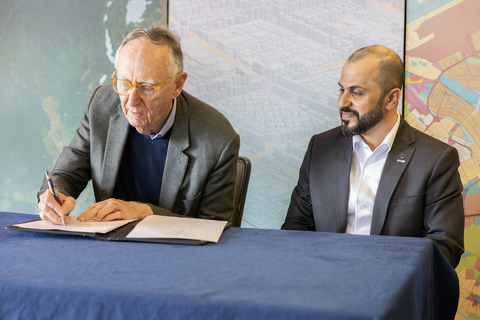
Formalised earlier this month at the 2025 Esri User Conference in San Diego, the Memorandum of Understanding (MoU) signals the launch of the Map Africa Initiative—a five-year collaborative project targeting scalable, high-resolution geospatial data across all 54 African nations.
The partnership is expected to have a significant impact on more than 1.4 billion people by addressing a major data gap: the fragmented, outdated or inaccessible maps currently used by many governments and businesses in Africa. These limitations have led to widespread challenges in infrastructure planning, economic development, investment, and governance.
“Transforming satellite imagery into detailed, accurate base maps at a continental scale requires advanced geospatial technology and professional workflows,” said Jack Dangermond, Esri president. “With Map Africa, we are helping to establish a foundational resource that will drive infrastructure planning, economic growth and sustainable development across the continent.”
Under the partnership, Space42 will lead project management and fundraising, while also supplying satellite data to power the mapping process. Esri will spearhead the production workflows using its GeoAI and remote sensing technologies. Microsoft will provide the secure cloud and AI infrastructure via Azure, enabling data integration, sharing, and processing at massive scale.
“Partnership is core to the UAE’s DNA and is central to how Space42 operates,” said Hasan Al Hosani, CEO of Smart Solutions at Space42. “This collaboration with Microsoft and Esri is more than technical; it’s strategic. Accurate, high-quality mapping and the intelligence solutions built on it are essential for growth, resilience, and inclusive innovation.”
The benefits of the Map Africa Initiative are expected to extend across several sectors:
- Ports and logistics: Improved terrain mapping will enhance route planning and reduce inefficiencies.
- Renewable energy: Site selection for solar and wind energy will be optimised through accurate geospatial models.
- Disaster response and security: Enhanced mapping will help governments monitor borders and respond swiftly to crises.
- Smart cities: Urban development and digital infrastructure will be better supported with precise location data.
To ensure long-term sustainability, data generated through the initiative will be licensed to national governments, allowing national mapping agencies to maintain and update their datasets. The project also envisions a thriving ecosystem of African startups and geospatial innovators leveraging this new foundation of data.
Map Africa data will ultimately be housed in data centres managed by G42 and Microsoft across the continent, enhancing digital sovereignty and resilience.
For more details, visit: esri.com/about/newsroom/arcnews/in-africa-sustainable-development-hinges-on-having-accurate-basemaps

